Friday, October 30, 2015

How big of a model would you have to build to recreate the entire Island of Sodor using Thomas toy trains?


It doesn't appear anybody out there in the blogosphere has asked or answered this  fascinating   question.How big of a model would you have to  build  to recreate the entire Island of Sodor using Thomas toy trains?

I'm not a  mathematician and I know very little about model trains. I am  not sure I have all the proper  variables, but here goes.  A napkin calculation, if you will.

Thomas the Tank Engine's home, the Island of Sodor is  62 miles from east to west, and 51 miles north to south. That converts to a grid of of 3162  square miles including the surrounding sea. The actual land territory of the island would be less than that. Nobody seems to have taken a guess at the actual land area.  The land area would between 1 and 2 million acres. We know the Island of Sodor is about this size because the island is supposed to be able to fit cozily in between England  and the Isle of Man.  3162 square miles is something like 2 to 3 times the size of Rhode Island or half the size of Rhode Island and Connecticut together. There are numerous maps of  Sodor -based on the author's Rev. W. Aldrey's original map. Mapping the island for a  model wouldn't be a problem.

So this model we are  building has to  show every inch of the island, has to to be the scale of Thomas the Tank engine toy trains.  Those trains are said to be of a scale of 1:32 of real tank engine.  So that's 3/8 of inch to a foot. So your model  setup has to be something like 1/32 of the real thing.  

How far in   feet is 62 miles?  327, 360 feet.  A real Thomas train engine would be at least six feet wide and run on 4 feet wide tracks.  The original British WWI era  train (called the E2) that   Thomas based on was 33 feet long.  So lengthwise with no clearance, 62 miles is   something like 10,000 trains lengths.   The main line on Sodor that goes East to West is actually 80 miles long because of curves.  So even allowing for proper  clearances, that's a lot of trains. So imagine this with model trains. Your model has to be big enough to accommodate a rail line that could  line up  10,000 model  trains back to back.

So anyway 1/32nd of 327, 360 feet is 10,230 feet. That's about the distance between the US Capitol and the Lincoln Memorial.   So  the model would have to be nearly 2 miles long.   1/32nd of 51 miles is around 8500 feet.  10230x 85000 =About 86,000,000 million square feet. A 86  million square feet foot warehouse  to house a model of the  island of Sodor would be four times the size  of the world's largest building by footprint.  That does Seems awfully big. About 3 square miles.  When  I calculated it  the first time I got a smaller area, so my number could be wrong  but however   big  the model is it   couldn't  be in a building. So you would have to landscape a park just to create a  outdoor model of the island and spend millions on fake trees, building  models, non-moving people, and  train tracks. To make it look realistic you would have to cover up all the grass, and not have any  real trees. You might have to build a moat to create the effect of Sodor being an island. 

Now model trains, suitable  for  being outside  (so-called Garden railways) are often bigger than Thomas toy trains. So  the layout might have to be even bigger to reflect that.  Can you imagine a little toy train traveling for miles on end simply on batteries? I imagine they can't unless they have some kind of souped- up engine.

A full scale model of Sodor would probably just be too big to build.   Maybe just a portion of Sodor could be built.  Or Maybe you could just CGI the whole thing....
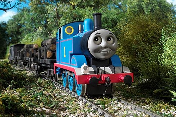

Hey's It's Thomas!

P.S.  The creator of  the Thomas the Tank Engine   TV show, Britt Allcroft is actually a women.
I didn't know that. She hasn't worked on  the TV show for years. I didn't know that  She is very rich-I knew that.


Wednesday, October 21, 2015

History of the Rockshire development, Rockville, MD


The farmhouse, the pool and surrounding townhouses.
Rockshire is a housing development in the west part of Rockville, Maryland.
The development was built on farmland that was originally owned by Thomas Sprigg Wootton and other Wootton family members. T.S. Wootton  was  the founder of Montgomery County in 1766.  His son,  Richard Wootton owned the grist  mill (no longer extant)  referenced in the Wootton's Mill Park name.  


In the 1800’s the Wootton farm was owned by the Benson family. By the 1900’s the farmland  was known as the Two Brothers farm, and it was under that name when C.C. Veirs became the last owner to run it as a farm.

The farm was one of many dairy farms in the area.  The adjacent property to the Northeast was the Winding Lane  farm owned by the Hurley family-the Hurley-Carter farmhouse is still extant and is located 411 Feather Rock Lane.  Further north on the North side of Route 28 was the  giant King Farm, which was only fully developed recently. 

Two Brothers Farm house
The Two Brothers Farm house is still extant. It can be  found right  next to the Rockshire community pool. The farmhouse was at the center of the original property, and was built around 1880. The  unpaved  road that leads from the farmhouse originally terminated at West Montgomery Avenue.  In the 1900’s the farm was a dairy farm, till the last owner, C.C. Veirs sold all but  1.5 of 500 acres  to a developer  in 1959.  The Two Brothers farmhouse  sat on those 1.5 acres. C.C. Veirs died in 1973, and the farmhouse was sold to somebody outside the Veirs family during the 1970’s.  The Veirs family had  also had other  houses nearby including  the original location of the  A.B. Veirs Paving firm which included the original log cabin built near Wootton's Mill   and a  house built in 1951  that eventually became the Karma Academy(that house burned down recently ). Thomas Veirs owned a house on Route 28 near Glenora Hills (that house was replaced  recently by a commercial property")


Rockshire was transferred from builder to another
Rockshire before development, 1952

Rockshire area 1963


A view of what eventually become Aintree Drive, and Wootton Mill  Park.    (Billy Veirs and Neil Bernstein)

The development of most of the Two Brothers farm land  did not start till 1969.  The Yeonas company built most of the houses of Rockshire in the early 1970’s.  The first development, the building of Hurley Avenue and the houses near the west end of Hurley avenue were  called Tract One.  Tract one  was built in about 1970-1971. Some of these houses are not part of the  Rockshire Association.  '


Surveyor's documents for Eton Overlook, 1969

Tract Two was built in 1971-1972, these were  the  townhouses near Wootton High School.   Tract three were the houses on the East side of Watts Branch which  were built next in 1973 and beyond. Two  further large tract of houses adjacent to Lakewood Elementary were built   in 1974.  At least two other small tracts were built later, these were the luxury townhouses near the village pool, and a  few houses built in 1990  on  part of the old A.B. Veirs property.  
 
The nearby housing developments of Glen Hills, Glenora Hills, were built before Rockshire.  Fallsmead, Carter Hill and Saddlebrook  was built around the same time as Rockshire. Watts Meadows, Horizon Hills, Fallsbend, Cambridge Heights, and Fallswood,  were built afterwards. The Lakewood country club was founded in 1960.  The gas station and the hotel at Hurley avenue and Route 28 bottom of existed   from the early 1970’s on. Nearby Route 28 existed before Rockshire but   was straightened in the 1970’s or 1980’s as was nearby Seven Locks Road.
 
Rochshire area partially developed in 1975.

The adjacent interstate highway 70S predated the development and was fully in place by 1960. The Highway number was changed from 70s to I-270 in 1975. 

Houses in a exit ramp

Originally the highway  exit ramp to Route 28 had actual houses inside the exit loop, but these were eliminated when the bridge over the   exit was rebuilt, in the 1980’s.  In 1989, I-270 was widened to twelve lanes (2-4-4-2 configuration) from the wye split in Bethesda all the way to I-370 (9 miles). The exit on Fall Road was reconfigured around this time.  The long pedestrian bridge at the  Route 28 exit to 270 was built more recently.  The state police barracks (since closed)  and the small  Water gauging  station  in Watts Branch  Park predated Rockshire.

 
Location of Frost and Wootton schools


The neighborhood schools were all built originally between 1969 and 1974. Lakewood opened in 1969, Wootton in 1970, Frost in 1971 and Fallsmead in 1974.  These schools have been renovated or rebuilt (Lakewood) since then.  Wootton High School is highly ranked in lists of the nation's best public high schools-and the  high property values in Rockshire reflect that!

Wootton Parkway (originally called West Ritchie Parkway) was built in sections; the  first section was originally the preexisting Scott Drive that starts at Fall Road.  The next  section built  was the section  near the Rockshire shopping center, the bridge over Watts Branch was added in about 1972. The section of  parkway that goes by Lakewood Elementary School was built next, and the part of the road that goes East from Falls Road into Rockville was built much later.   Originally it was thought that the Wootton Parkway would be a divided road, thus the wide road bed (and never used support pylons on the bridge over Watts Branch)  but that never occurred and instead a path was built, now called the Millennium trail.    The two traffic circles on Hurley avenue are recent additions.  

The Rockshire pool was built in the early 1970's at the same time as the development,  the nearby Collingswood nursing home was built in the 1970’s.  

The two other   buildings on Hurley Avenue , were added  a few years after the development was built.   Among them was the Temple Beth Ami which operated in a building near the Rockshire pool from 1980 to 1998 (it  moved to a new building on Travilah Road).  The Korean Presbyterian Church took over that building.  Further up on Hurley Road currently  is the American Latvian Association.

The paths and pedestrian bridges in the Watts Branch park were added in the mid to late 1970’s.  
The Rockshire Village shopping center was opened in 1978 , and the Giant grocery store anchored it till  2012.  The shopping center was originally going to bigger but was downsized in the planning process, plans for a possible post office or library was also shelved in 1980, (instead the luxury townhouses near the pool were built). The shopping center  was shut down in 2015 and plans are to replace it with  houses.   Rockshire is now over 40 years old and has  753 homes, it is one of the largest  and best developments in Rockville.


Related links:
A History of Winding Lane Farm (site of Carter Hill)

411 Feather Rock lane (Hurley Farm House)  

History of the Two Brothers farmhouse  

History of Fallsmead from the Fallsmead website

Why is Veirs sometimes spelled Viers?


The sections labeled 41 are Rockshire..

Originally published October 2015, by J.C.Bernhardt